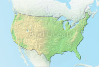
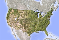
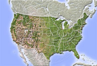
USA, shaded relief map

USA, shaded relief map
USA, shaded relief map
Map series: MarbleRelief-USA-D
Description:
Relief map of the USA with international borders and cities. Labels in English.
Projection: Lambert Azimuthal Equal-Area
The image is protected by copyright and no free use is allowed.